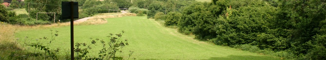
​Symonds Yat

Symonds Yat

Another hot summer’s day found us parking in Whitchurch off the A40 near Symonds Yat. A short walk across the A40 by a road bridge and there was a footpath which brought us to a lane heading south. All too soon we found ourselves climbing which seemed a little odd as we were making our way to the River Wye in order to cross it via the ferry. Arriving at Ferry Inn we were disappointed to find that the ferry wasn’t working but our contingency plan was to walk along the western bank of the river.

Imagine our delight when after walking about ½ mile down river we found that the second ferry opposite the Saracen’s Head was about to leave the shore on the other side. This is a rope or hand ferry joining Symonds Yat East and West. Ferries like this were vital, in the past, linking the communities on both sides of the river. We paid our £1.20 a head and boarded; the river was so low after the extended dry spell that a box had been placed on the boat to ease stepping down to the ferry. The ferryman sang as he took us across in memory of ‘the singing ferryman’ who died in 2011.

On reaching the other side we went through the large car park at the foot of Symonds Yat Rock. Peregrine falcons can be seen at Yat Rock from early spring. Now we were following an excellent footpath and cycle way alongside the Wye with trees providing shelter from the summer’s heat.

The brooding presence of hillforts built by Iron Age tribes, commanding wide vistas high above the Wye, reinforces the feeling that this has been border country for millennia. Tourists discovered the beauty of the Wye in the 18th century when it became fashionable to take the Wye Tour and find inspiration in the picturesque viewpoints. After a while we came to the chain bridge. Six people at a time can cross. We waited patiently each side taking turns, the second half of our group found that 5 cyclists joined us when we were halfway across and the bridge started to bounce a little alarmingly – not good for those of us who have problems with heights.

Passing a campsite we met lots of families cycling and walking in the sunshine. Delicious blackberries at the edge of the site were quickly devoured. Even

though we had crossed the river, we were on the eastern side of the river again as there is a loop here. Now we were headed north.

After about a mile we turned right up a steep hill through woodland and just before reaching King Arthur’s Cave turned left out into the full heat of the midday sun and continued upwards to a hillfort. Lunch at the top of Little Doward hillfort gave us views to the southeast with the river far below us out of sight.

Towering 724ft above the River Wye, with steep cliffs on three sides the Little Doward provided the ideal site for an Iron Age hillfort. It was improved only by the construction of a single massive rampart around the enclosure. Recent archaeological exploration has found that people here lived in circular platform houses. They worked animal bones, making items like toggles and dice, which were found during a dig in 2009. The limestone bedrock has enabled the preservation of bone here.

We descended the hill, circling to reconnect with our original path and travelling northeast. Soon we were at King Arthur’s cave. Victorian and Edwardian naturalists were fascinated by the Doward Hills. This large limestone cave held a particular draw. Excavations reveal that people have used this cave for 20,000 years. Prehistoric animal bones – of hyena, rhinoceros, bison, lion, bear, reindeer, horse and giant deer – were discovered 11 feet below the caves present floor. Large openings allowed those of us who were interested to explore the caves without ducking, some had torches and further caves appeared as we continued. Did King Arthur really come here, we wondered.

Continuing downhill via steep lanes we were soon passing through Great Doward and found our way back across the road bridge to Whitchurch.

This was a lovely walk much of it easy – especially the ferry ride – 7½ miles and 1200ft climb. A small delicatessen supplied us with cups of tea and the bar of an Indian restaurant had beer so we were all happy.


Mynydd Troed

.

Mynydd Troed

Parking at the Dragon’s Back Inn, we were about to tackle the hill we had seen when circumnavigating Llangorse Lake. We headed north around the bottom of the mountain skirting Pengenffordd. Grassed paths all the way made the going easy and coming around to the western side of the hill we started to climb – fairly steep but not too difficult. As we climbed Llangorse lake came into view to the west.

Turning a corner the wind lashed at us and the temperature dropped a few degrees – quite pleasant after the warmth of climbing. Looking into the valley below a large stretch of land stood out, a lighter green than the rest.

On reaching the trig point (609m) we stopped for a breather. The Dragons Back ridge was in view and mountains stretched far to the south. It was now an easy walk along our ridge. There had been a fire up here; the majority of the ridge was brown and it was still smoking in places. The grass path was largely undamaged but heather and winberry bushes were all gone leaving ash in their wake. At one point flames were spotted and someone stamped them out. It was clear that although the surface was charred there was still heat in the ground and burning could be hidden below. We wondered whether it was a controlled burn, the result of hot weather or arson. We also joked that the dragon of the Dragon’s Back had breathed fire over to Mynydd Troed.

At the end of the ridge we descended a zigzag path through lush grassland and picked up a road through Waun Fach before reaching the end of the hill and turning north to follow the lower reaches of the ridge. We followed a very pleasant path for over two miles that felt like an old drover’s road but that is unlikely as it is between the A479 and a small country road.

An 8 mile walk and 1700ft climb was followed by excellent tea and a special treat of homemade cakes (delicious). As we finished our drinks the heavens opened – the weather forecast was right to the minute! Map OL13


Llangorse Lake


 Llangorse Lake –  

Parking at the lake, we set off to circumnavigate it. We headed across fields to a solid bridge allowing us to cross a feeder stream. We spotted well constructed bird hides at the edge of a group of trees; three of the oaks here were probably planted when Queen Elizabeth I was on the throne. In the distance at least 2 dozen swans swam on the lake.


Llangorse is the largest natural lake in South Wales. It has been a feature of the landscape since the ice retreated 11,000 years ago. At that time the outflow to the Wye valley may have been blocked by ice. The lake would have been much larger causing it to spill over into the Usk valley. By the Iron Age it was only slightly larger than the lake we see today and it was important to local people for both food and ritual purposes. It is an important stopover for migrating birds.

We joined the road by the church at Llangasty with Celtic knot work on its notice board and a lovely rectory next door. The church is mostly Victorian but is built on an ancient ‘Llan’, or settlement, that was created by St Gastyn in 420AD. St Gastyn was a holy man and tutor to the Brychan family, who helped extend Christianity in southeast Wales.

Passing Newydd farm we took a road towards Cathedine. At this point we started to notice dark skies all around the surrounding hills, threatening rain. Silhouetted against the sky stood the beautiful skeleton of a tree, still standing though stripped of all foliage and signs of life.

Then we faced a steep climb. Passing Treholford light rain started to fall. As we stopped for lunch at the edge of some trees on a comfortable bank we had misty views of the lake below. Getting closer to Llangorse, we could see the lake clearly but the clouds gathering on the hilltops were getting darker by the minute. We donned waterproofs in preparation for the inevitable downpour. We walked through a field full of a white daisy type flower (oxeyes or feverfew?), the expanse of them was beautiful to behold.

To our right the bluff of a hill appeared – ‘we’ll be going up there in a couple of weeks’!

Across a couple more fields and we were passing a farm where a sheepdog was keen to let us know he was looking after them. Only one big field to cross and the sky was looking ominous ‘do you think we’ll make it back to the cars?’ Someone said ‘yes but we’ll have to get a shift on.’ So we did and the big drops started to fall as we reached the cars.


It had been the first damp walking day of the summer, a bit of a relief after the heat. 7 miles walked and 600ft climbed.


Llandegfedd Reservoir


It was a bright, sunny morning as we parked at the visitor and watersports centre in Coed y Paen near Pontypool and Usk, just a few miles north of Newport. Our walk was to follow ‘the Reservoir Trail’ which circumnavigates Llandegfedd reservoir. The route is possible because Welsh Water have made two sections of their land permissive paths; the remainder of the trail is public footpaths or roads.

The reservoir was constructed after Cardiff Corporation was granted permission in 1958 and it was completed in 1968, covering 434acres it has a capacity of 5,300million gallons. Only 3% of the water is rainfall the remainder is pumped from the river Usk. Llangedfedd reservoir has been designated a Site of Special Scientific Interest (SSSI) for its importance to over-wintering wildfowl and because of this the reservoir is closed to all activities from 1st November to 1st March each year. Its northern edge has nationally important grasslands which are managed as hay meadows encouraging biodiversity. Flowering plants include several orchids and yellow rattle as well as orange foxtail grass and adders tongue fern.

From the car park we followed the tarmac path down a steep slope to water level, passing 5 red pictures on posts, if you look through the viewing rectangle at the side of the path all these magically line up to produce a single image of a pike. The British record pike (46lb 13oz) was caught here in 1991.

We crossed the dam enjoying the peace and quiet of the water in the morning sunshine (though we had to avoid some cars travelling towards us). At the far end of the dam we turned left and immediately climbed into the shade of woodland, where we spotted our first foxgloves of the season. After about 1km we passed a bird hide on the edge of the lake and then followed an inlet of the reservoir, which is a breeding ground for otters. We were not lucky enough to see any.

At the end of the inlet we turned north passing the entrance to Trostra Farm, their metal signpost drew admiration from all of us and gorgeous purple clematis in full bloom grew nearby. Continuing through woodland the men of the group helpfully held up a large fallen tree so that the rest of us could pass under it (in reality it was set in its location).

Going through Twyn y Cryn woods, we came out at the top of a field. We stopped here for lunch, even though it was only just after noon, as there were good views of the reservoir and surrounding landscape. One sheep in the field showed a little interest in us but the rest continued grazing.

Near Yew tree farm a late Bronze Age hoard (the Glascoed Hoard) was found and is on display at the National Museum of Wales in Cardiff. Soon after we passed another bird hide which is in the area that is closed in the winter. From here we continued south enjoying open views of the lake and spotting a fisherman wading in the water. There were stretches through woodland that were very muddy and slippery underfoot but it was dry in the more open ground. Woodlake Park golf course was on our left and a number of wooden seats were available for anyone wanting to relax.

Despite the warm day, we arrived back at the visitor centre at 1.30pm – one of the earliest finishes for one of our walks, having walked just over 6 miles and climbed 650ft. This was partially down to the good quality of the paths but also the pace set by those in the lead!

We took advantage of the refreshments on offer at the award winning centre. It was named ‘Welsh Building of the Year’ in 2016 by the Royal Society of Architects.

This would be an excellent walk for anyone new to walking who wants to get out into the countryside, throughout the walk there are fingerposts directing you around the reservoir trail. Parking at the centre is free and the facilities very good. The area was bustling with families and people enjoying the many water sports available at the reservoir. Map152 or use walk leaflet no 7 ‘The Reservoir trail’ created by Llanbadoc Community Council.


Usk Walk


Parking in the main car park at Usk, site of the Rural Life museum, nine of us set off through the streets of Usk. We passed a small but delightful garden created by local Girl Guides. Soon we found ourselves turning left to climb a fairly steep slope. It was a warm morning and we were glad of the dappled shade provided by trees around us.

Soon we were passing the back of Usk castle. At the entrance was an old sea bomb and behind it a face peering out of a tree stump from which it had been carved. The ruins of the castle overlook Usk and the river beyond. A medieval castle it fell into disuse 500years ago. It is open to visitors almost every day and entry is free with a donation box.

Climbing Beech Hill we were soon passing the site of the battle of Pwll Melyn, also known as the battle of Usk. This was part of the Welsh War of Independence against English rule that lasted from 1400 to 1415. The battle occurred in spring 1405 and the defeat of the Welsh rebels here was devastating. It included the loss of important leaders and men. A contemporary Welsh chronicle described it as a ‘slaughter’ and that ‘It was now that the tide began to turn against Owain and his men.’ According to historian J. E. Lloyd writing in 1933 ‘Pwll Melyn is the pond lying northeast of Usk castle …numerous skeletons were found in the pond when it was cleaned out. The pond is so called because the water is always slimy and of a dirty colour.’

But we were here on a beautiful May day with wall to wall sunshine and travelling north we passed a delightful pond with a wooden bench beside it which had a dog carved into the backrest and a carved bottle and glass resting on a ‘table’ at the front. Continuing north we took a solid footbridge across a stream, followed shortly after by a stile leading to particularly boggy ground. Two large horses showed interest in us as we each found our way across the mud. It was near here that we spotted an early purple orchid.

Coming up towards Trostrey Common we started to enjoy far reaching views. We continued climbing to our high point for the day above Hill farm and now

had 360o views. Stopping in an open field we relaxed in the sunshine and ate our lunch looking out across the valley with the river Usk somewhere below us.

The heat of the day was building as we turned south back towards Usk. We passed Trostrey Court (there is also a Trostrey wood). Trostrey Court House is a late 16th C gentry house, the current building replaced a medieval court. During the English civil war it was seized by the forces of Thomas Fairfax during the siege of Raglan castle. It remains a private house and working estate and the court is a grade II listed building.

Walking through a field of ewes with their lambs we caught a glimpse of a windmill, with vanes, in the distance and walking along a stretch of road we came closer to it. This is Llancayo windmill – ‘luxury accommodation, sleeps 12 and is available to rent £2250-£3850 a week!’

A field in the far distance was black and we wondered what the crop could be as the earth in this area is brown. Our best guess was flax in its early stages. We eventually arrived at a large solar farm – we’d seen the backs of the panels. Walking past it we were instructed ‘DANGER OF DEATH KEEP OUT’.

Passing a large piece of farm machinery trudging up and down a field, we made our way down to the banks of the river Usk. Shelter from trees and the freshness of the water both helped to cool us as we meandered with the river all the way to Usk and the stone bridge that crosses the river. An Usk Civil society blue plaque on a wall nearby declares ‘ Conigar walk (conigar from coney or rabbit warren, denoting a medieval enclosure to provide rabbits for food)… built in 1858 to commemorate the marriage of Victoria, Princess Royal, to Prince Frederick of Prussia.’

It had been a glorious sunny day, a bit humid at times, and a lovely walk – 9 miles with an 800ft climb. Tea in the café attached to the museum was much appreciated. Map 152.


Trelewis and Govilon

Trelewis

Heavy rain overnight, which continued as we drove up the A470, suggested that we were to get a thorough soaking and trudge through mud for much of the walk. How wrong we were, the rain was light as we left the cars in the Taff Bargoed Park and soon stopped completely. We followed a solid path north along a full Bargoed River. Geese, ducks and swans were enjoying the water. An attractive insect hotel had been built on the side of the path.

On the edge of the river were fishing platforms which we didn’t step onto as we could imagine sliding across the slimy wet surface straight into the river. Wild fishing was established here in 2012 by the Environment Agency Wales (partly funded by the European regional development fund).

In 1994 mine water containing iron salts flowed from two of the disused mineshafts of local mines via a culvert into the river, staining it orange for many kilometres. Reed beds using more than 100,000 individual reeds were planted, creating one of the largest reed beds in Europe. The effect is amazing we could see bright orange water replaced by clear flowing streams. The reed beds while forming a natural filtration system provide habitat for mammals, birds, amphibians, insects and invertebrates.

Continuing north we reached the Bargoed Rock climbing centre.

Soon we left the river and turned west across moorland. We contoured around a hill and headed south. Just after Pen-heol-Adam farm was a solar farm and we decided to stop for lunch as the views were good and a comfortable bank beckoned. A tar macadam track took us through the centre of the vast solar farm and we noticed little hatches in the strong metal fencing for letting small animals through, though there was evidence that they just burrowed under it wherever they wished.

On reaching Hendai farm we headed across farmland, towards LLancaiach Fawr, and encountered our first real mud of the day (the stuff that clings to your boots and makes them heavy). An amazing tree had a strange shape and a ladder of fungus grew on its trunk. Crossing the road at Llancaiach Fawr we headed to Llancaiach village and re-entered the Taff Bargoed Park following the coal seams which we had seen a couple of months ago.

Eight miles walked and an 800ft climb we felt extremely fortunate to have had excellent paths and a dry day. Map 166


Govilon

We set off from Wenvoe on a misty morning and were pleased that it brightened up as we drove north of the M4 towards Abergavenny. Parking near the tramway at Govilon, we started out in sunshine and soon passed Govilon station, now a private house but decorated with railway memorabilia – including London Midland and Scottish railway company signage, dated August 1924, promising a forty shilling penalty for trespass.

Soon we moved onto farmland heading generally south. The fields were full of ewes with their lambs and overhead we spotted two buzzards and a kite.

Climbing steadily towards the Blorenge we took a track passing Garn ddyrys farm and leading to a road where we found an imitation blue plaque for the farm attached to a stone. Crossing the road we took a footpath which contoured around the north of the Blorenge. This wide grassy track degenerated to a narrow rough path as we passed close to woodland. Large machinery was clearing some of the trees and loading huge tree trunks onto the back of trailers.

Lunch was taken on a comfortable slope above the wood with the sun beating on our backs for the first time this year.

Continuing we could see Sugarloaf and later Skirrid in the distance. After Pen y Craig farm we followed a stream downhill through Glebe wood to the Brecon and Monmouth canal at Llanfoist. A sign at the bottom stated ‘access to the towpath is only through the tunnel’. The sound of thundering water passing through this tunnel was somewhat off putting, especially as the ground looked really wet. Entering we found the tunnel was a good height and totally safe, the water flowing in a separate channel. Emerging we could see Abergavenny ahead of us. Now we were to take a gentle stroll along the canal back to Govilon to complete the walk. But we were disappointed to find that the towpath was closed for embankment repair between Llanfoist and Govilon. Luckily the tramway was nearby so we were able to follow that back to Govilon. Once again we spotted birds of prey soaring above us and passed a wharf with a number of boats.

We drove to the Horseshoe Inn, Mamhilad for refreshment and enjoyed sitting in the sunshine and watching sheep on the hillside. A glorious day, with lots of spring flowers and a lovely walk covering 7miles and 1100ft climb. Map OL13


Clytha

Clytha – It was the middle of March and snow flurries persisted as we drove east, the hills to the north of the M4 soon had a dusting of white. We started at the National Trust car park at Clytha Park. Clytha is an18thC landscaped estate consisting of the park, house and castle near Abergavenny.

It was bitterly cold in a brisk easterly wind. Taking the footpath to the river Usk we walked south along the river, which was high and flowing very fast. Immediately we spotted mistletoe high up in the tops of many trees, outlined against the winter sky. South of Clytha castle we turned west taking footpaths across farmland and began our main ascent of the day.

Clytha Castle folly is a castellated and romantic Gothic retreat overlooking the Usk valley. William Jones, of Clytha Park, moved back to Wales in 1787 from London with the intention of creating his own personal memorial to his recently deceased wife, Elizabeth (last surviving child of Sir William Morgan of Tredegar house). The folly was designed by John Davenport. A tablet set into the wall bears the inscription ‘it was undertaken with the purpose of relieving a mind afflicted by the loss of a most excellent wife’. The impressive gateway was designed by John Nash. The castle was connected to the Park by a carriage drive that crossed the Clytha Gorge via a suspension bridge. For a time it was used by a gamekeeper. Empty since 1948, the Landmark Trust rescued it in the 1970s; it stands on the slopes of Clytha hill, at the edge of a grove of chestnut trees.

Turning north towards Twyn farm and then Whitehouse farm where we joined a road which would take us across the A40 via a bridge. The ground was very wet and heavy clods of earth decorated our boots, something we would enjoy many times on this walk. Even the lanes were flooded in places but keeping to the centre of the road we navigated them without anyone getting wet feet. We spotted a huge flock of seagulls on the edge of a pond which had formed in one field.

Soon the Skirrid, then Sugarloaf and finally the Blorenge came into view, all of them covered in snow and glowing against the dark sky. These hills were to form a backdrop to much of our walk, glowing whenever the sun touched them.

We walked through Clytha village, spring flowers and even a cherry tree bloomed lifting our spirits. It has a Roman Catholic village school, Ysgol Clytha, built in1858 and now a private house. Behind the school we were surprised to see a Roman Catholic cemetery which is still in use. The church, St Bridget’s, is at the other end of the village. Clytha village was home to the Monmouthshire polo club, the first polo club in Wales, founded 1872.

At a T junction we crossed the road to head northeast, glancing to the right we could see an impressive gateway to Llanarth Court. Hats were drawn down to eyebrow level and hoods raised as the icy wind came straight at us. Now it was lunchtime so we hunkered down behind a hedge for shelter and a short rest.

A farm had long-horned cattle, a bull and cows in the muddy farm yard looked bedraggled. Continuing we turned right at a road, walking along it for a short way and then heading across country towards Llansantffraed Court hotel, a splendid house with a fountain and picnic table in the grounds. From here a tunnel took us under the dual carriageway and back to the banks of the river Usk. Walking south we caught a glimpse of Clytha castle on the wooded hill and were soon back at the car park.

We had spotted lots of spring flowers in different locations – the last of the snowdrops, primroses, daffodils and the first swathes of anemones.

Despite the bleak and bitterly cold day it had been a lovely walk and we agreed that we felt thoroughly refreshed, if a little tired at the end. It was 8 miles with 650ft climb.

We stopped at the Secret Garden centre, Pontypool on the way home. The greenhouses were a riot of colour, as they were full to overflowing with primulas brought inside to protect them from the weather. Chickens wander freely and they were hiding under the shelving, crowing loudly as we passed. Tea and the warmth of the café were very welcome.


Quakers Yard and Hendryd Falls


Quakers Yard –

Starting at Quakers Yard, until the 18th Century, known as Rhyd y Grug, ‘the ford of the rustling waters’, where the Bargoed Taff and Taff rivers meet. Its name changed when land was bequeathed to the Quaker movement for use as a burial ground or yard. Until the 2nd half of the 19th century it was a picturesque rural village with 2 inns and little industry. Neighbouring communities developed later around the coal trade, local streets are named after influential Quakers and Treharris is named after William Harris, who came from a rich Quaker family.

Travelling east we walked alongside a turbulent river taking us to the Taff Bargoed Park, built on the site of old mine workings. The river has been dammed to create lakes, providing habitat for a diverse range of insects, birds and small mammals.

The manmade channels carrying water through the park were churning after heavy rain and occasional waves rose along the sides of the structures. Paving on the main footpath indicates the position of coal seams, each over 2000ft deep. Leaving the park and walking up a hill we noted that even the road had fast flowing water and we were lucky it was not icy.

On reaching the outskirts of Trelewis we headed northwest across open land. We spotted a large herd of horses in the distance (redolent of a scene from an old western film).

Continuing we came upon the site of the remains of an old chapel at Cefn Merthyr – hardly visible in undergrowth. There was a murky view to the west, of a green and brown hillside but looking north towards Merthyr a watery sunshine which we called ‘the promised land’ – it was so long since we’d seen sunshine.

Reaching the eastern edge of a woodland, we continued north for a while before turning south through the wood. It was quite atmospheric, the trees being covered in moss and the clouds low. Moving closer to the edge of the track to peer into the wood we were staggered to see a huge tyre dump. Coming out of the wood, Aberfan came into view across the valley and we stopped for lunch.

Continuing in a southerly direction we entered the Pontygwaith Nature reserve and the Taff trail at ‘Trevithick’s Trail’ which follows the old tram road from Penydarren to Abercynon along the river. The tramroad is famous for being the first in history to carry a full load of iron and passengers. On 21st February 1804 the train travelled 9.5 miles in 4hrs 5mins! Sleepers buckled and split with the weight and the engine’s boiler broke on the return journey to Abercynon.

Looking west across the valley, the gap in the hill which is known as ‘the dinosaur’s footprint’ is visible here. Tram road stones for the railway are still clear on the ground in places. Soon we reached the magnificent viaduct which crosses the river Taff. It has double arches which were built separately but now form a single structure enabling 2-way traffic.

Continuing down the trail we came to Quakers Yard station and from there returned to the cars. We agreed that, despite a cold, grey, winter’s day we had enjoyed a good walk with the bonus of being on proper tracks the whole way – much appreciated after heavy rain and the amount of mud around. The walk was 7¾miles and 800ft ascent. Map 166.


Hendryd Falls

Last June we parked at Coelbren and walked south towards Banwen. Local tradition claims that St Patrick, patron saint of Ireland (and patron saint of Nigeria), was born here. He engineered the development of arts and crafts after he introduced the use of lime and mortar to Ireland. Enabling the initial construction of clay churches in 5thC AD, he taught the Irish to build arches of lime and mortar instead of dry masonry – this developed into organised crafts.

Just beyond Banwen a raised path crosses a boggy field and leads to a wetland area. There are ponds for wildlife and fishing. The grass around was full of flowers – orchids, buttercups, ragged robin and iris to name a few.

We turned east towards woodland and then north towards Dysgwylfa. We passed a wide waterfall on the river and stopped for lunch later. A sign ‘Caution Pedestrian Crossing’ stood alone in a wide expanse of open land. At Sarn Helen (old Roman Road) we turned west and at Tonfildre Farm turned north towards Hendryd falls.

A steep descent to Hendryd falls is eased by lots of steps. The spectacular waterfall has a 90ft drop, the steep climb up the other side was harder than the descent but at the top we found we had parked just 5 minutes from the top of the falls. The walk was above Ystradfellte, 8miles and 800ft ascent. Map OL12


Cefn Mably and Ruperra Castle / Ystradowen


Cefn Mably and Ruperra Castle

We were lucky, there had been snow overnight; in Cardiff and the Vale the snow was light but further north there were heavy falls. Starting at the drive to Cefn Mably, near the farm, we walked towards the house and passed in front of it.

We turned west walking across farmland which was rather wet underfoot. Entering a large field, a herd of cows and a bull moved towards us. They split us into 2 groups most of us remaining in the open, but a couple apparently pinned at the edge of the field. Soon we could hear a tractor engine and the farmer arrived with feed – the cattle had heard the engine before we did and had no interest in us.

Approaching a river, we turned northwest towards Cefn Mably woods, keeping them on our left and then heading across open land. A house had an apple tree which had dropped its fruit and was now festooned with Christmas baubles. Surrounded by a light sprinkling of snow it looked very festive.

As we climbed higher more of the fields were snow covered and dark trees were edged in white. A branch of a tree, with a large chunk of wood as its base, was an attractive garden bird table.

We arrived at Coed Craig Ruperra, managed by Ruperra Conservation Trust, a notice offered logs for sale. Skirting the edge of the wood we arrived at Ruperra castle:

Ruperra Castle was built in 1626 by Sir Thomas Morgan, who was knighted by King James 1st. It was a typical Jacobean courtier’s house. King Charles 1st stayed here in 1645, visiting in an attempt to raise support for the royalist cause in the civil wars. However following defeat by the parliamentarians at the battle of Naseby, the Glamorgan gentry, realising the Royalists were about to lose the war, refused to help out. During the 19th Century the eldest son of the Tredegar family lived at Ruperra, which saw its heyday as a great Victorian country estate. Destroyed by fire in 1941 and still in a state of disrepair, it is now a Grade11 listed building supported by the Ruperra Conservation Trust.

Close to Ruperra Castle are banks and ditches formerly part of an Iron Age Hill fort and a large motte, probably constructed by the Normans around 1100. With its superb and commanding views over the surrounding countryside, it would certainly have provided a strong defensive lookout point.

As the weather was clear we took a diversion to the motte. The views from the motte were excellent, improved by the dusting of snow. We sat down leaning against its walls to gain shelter from the cold and eat our lunch.

Descending we saw a few fellow walkers – the first of the day. We came across a long stretch of laid hedging, the craftsmanship that had created it was clear in the skeletal ribs evident in the winter.

Leaving the Coed Craig Ruperra area we walked through a farm with a barn full of old crates and huge logs. Going under a power line we spotted a heron stood in the middle of a field, it didn’t appear to move a muscle as we passed.

Now we could see a road-bridge over the river Rhymney and within a few minutes we stepped onto the road, walking a short distance to the cars.

The walk was 7miles and 700ft climb. Map 151.Thanks to Ross Thomas for the historical information.

Ystradowen

Parking in Ystradowen we crossed the main road to a footpath. Setting off across farmland, towards Mynydd y Fforest, it was typically wet underfoot – so wet a pond had formed.

Some pigs wallowed in a particularly mucky area and later we saw more in an open field attended by a farmer.

On reaching Mynydd y Fforest we made our way through the small but pretty wood and generally southwest towards Llansannor. Emerging onto the road and looking north, the village ‘City’ stood above the area. Turning south we came to Llansannor church and spotted our 1st snowdrops of the year with white buds showing. We continued past Llansannor Court and farm.

Crossing a few more fields we stopped to eat our lunch. We could hear dogs yapping and as we made our way to the road for Trebettyn, we found the source of the noise, a number of small dogs penned in a garden. Unusually the house had gargoyles on its low perimeter wall.

Now we headed east towards Maendy and Prisk, mostly by road, and passed the entrance to Caeau farm. At Prisk we turned north passing Castell Tal y Fan farm and the remains of the castle wall. The track passed a field containing cows and a bull.

As we made our way back to Ystradowen the ground was muddy. Some of the stiles had been overgrown, some with missing or unsteady treads and others a bit high for some of us. Despite the mud in places it had been surprisingly firm underfoot for the Vale of Glamorgan and we had enjoyed the walk unspoiled by rain which had threatened throughout the day. The walk was 7 miles and 700ft. Map 151.

A map of any of the walks featured in this column is available as a pdf file from Ian .at ianmoody029@gmail.com


Chartist Cave & Abercarn


Chartist Cave

We started at Trefil on a cold but sunny morning, much better than the weather forecast. Walking north we followed the Brinmore tramroad which opened in 1815.

We soon arrived at a quarry and the footpath led us through it. It has been used as a set for Torchwood and Dr Who.

Emerging from the quarry we followed a good track and crossed it to look at ‘the Duke’s table’. This is a ring of stones with a raised mound of grass in the centre surrounded by a second circular mound. It is said that this was where the Duke of Beaufort had lavish lunches with water gathered from a nearby spring, on days spent hunting on the moors. The inner ring is the table and the outer the seating.

Continuing north, on the main path, we found a sign marking The Aneurin Bevan Heritage Trail – ‘Bevan was always welcomed on his visits to the quarrying village of Trefil, the northern tip of his constituency. He loved its lonely moor lands walking with his friends. The ashes of both Bevan (1960) and Jennie Lee (1988) were scattered on these upland slopes. “What the nation mourned was the tragedy which mixed with the brilliance and the genius, and what it did in expiation was to acknowledge his unique place in our history.” Michael Foot’

Here we turned east and shortly after northeast, enjoying glorious views in the unexpected sunshine. Large sink holes appeared regularly across this landscape.

Now we turned south east to make our way towards the Chartist Cave, which can be difficult to find. (See the cover article about the history of the Chartists). After a short walk across the moor we could see a large cairn on top of a hill. Then a heavy mist descended hiding it from view, so we walked on a bearing to it. From here the cave is to the east, we crossed peaty ground covered in heather. With the misty weather we calculated that after about 10 minutes we should have been near the cave and soon realised we were stood on top of it and found the opening.

After a brief exploration of the Chartist cave, we had lunch. The mist did not lift so we cut the walk short, following a small track southwest, back to Trefil. As we approached the village a kite swooped nearby.

The walk was relatively dry underfoot, despite the peat, with tracks left by many feet human and animal making the going easy. We covered 6.8miles and 600ft climb. Map OL13


Abercarn

We parked at the edge of the forest above Abercarn and walked downhill towards housing before starting to climb and taking a footpath in a north-easterly direction, we crossed open land keeping the forest to our right. Nearby we spotted a tree with the base of its trunk shaped like a teapot..

After a short distance we entered the forest travelling west briefly and then northeast again. The forest follows a steeply sided valley and a lot of trees had been cleared. The pattern the felled trees formed made us feel as if we were moving as we looked at them, even though we stopped. An abundance of next year’s foxgloves lined the footpath.

A short stretch of dark woodland was decorated with the remains of police tape – imaginations ran riot. Soon we emerged onto a minor road where we met a fellow local walker and his dogs. He was friendly and enthusiastic giving us tips about good places to walk in the area.

We continued along the road before turning east onto Mynydd Maen Common. As we did so, a car passed us, a door opened as it slowed and a small dog jumped out, whereupon the car drove off with the dog running after it. The car pulled into a lay-by about 400yds further on – a new way to walk the dog!

Crossing the common, the woodland still on our right, we noticed that thick ice covered water here. Misty, the dog, was surprised when she stepped into/ onto water and her legs splayed.

At the eastern edge of the forest we turned back south and enjoyed lunch with lovely views down the wooded valley. Then we had to walk down to the bottom of the valley – approximately a 500’ drop! This proved a bit of a challenge as it was largely covered in heather and bracken and extremely steep

Reaching the bottom, we followed a stream. A section of this had concrete sides and a dam, probably a sheep dip. We now followed good forest tracks above the stream. Glancing across the steeply sided valley, we could see our cars parked on the other side. We continued until we could drop into the valley and climb the other side back to the vehicles. The walk was 7.4miles and climb 1200ft.


1 6 7 8 9 10 11