Wentwood Forest & Tretower

Parc Seymour and Wentwood Forest

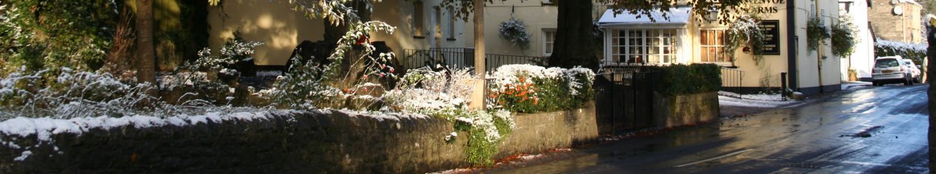
Today our walk took us from Parc Seymour to Wentwood northeast of Newport.

There was a cold wind and it felt like winter again. But there’s only one word to describe this walk ‘Bluebells‘! We headed southeast and on the road passed a neat woodland, a donkey and a group of beautiful horses. Then a little later we spotted a couple of shire horses ploughing in a field of bluebells. Now we followed the lane northeast and a field of bluebells appeared on our right stretching into the distance. We couldn’t help but stop and take photos and Misty (a dog) frolicked. We walked amongst them for ages, they were so thick that even the lane was covered in them and we were unable to walk without treading on them. We emerged into woodland which had been cut back hard and replanted.

Heading west we passed Hill farm and then went northwest towards Cross Green. Now picking a zigzag trail travelling generally westwards through Wentwood forest.

We soon found a tree known as the ‘Curly Oak’ an old tree which has split down the middle so that you can walk through its trunk.

The woodland was filled with English bluebells so that we were surrounded. Trees of beech and oak were in new leaf and the lime green and yellowy tones provided a perfect counterfoil to the purple blue of the bluebells. We just drank the colour in, wonderful. Unfortunately because it was cold there was little scent from the bluebells, just a waft now and again.

We came down alongside Bertholau Graig in a southerly direction and as we came out of the wood could see the Bristol Channel in the distance. The colours of the trees here were reminiscent of autumn there was so much yellow. Our route now travelled west until we met a road where we turned south.

We passed an old farmhouse with a dilapidated VW van and as we continued saw at least 20 abandoned old cars and farm vehicles on the property. We entered a large field where a herd of bullocks took some interest in Misty but eventually ran off uphill. Back at Parc Seymour we saw 2 carved wooden chairs on the green one dedicated to the AD and the other AD2000.

We had walked 8½miles and 1100ft. Map 152/OL14

Tretower

We started at the Cadw site in Tretower on a lovely Spring morning.

Tretower is the site of a medieval fortified manor house and castle. The Picards and Vaughans were influential Welsh families who created sumptuous accommodation reflecting their high status as Welsh gentry. The Vaughans left in the 18thC and Tretower Court became a working farm. It is an interesting site and Cadw have created a suite of rooms as they may have been in 1470.

Tretower is on the Agincourt Wales trail which tells the story of the people and places across the region that played a role in Henry V’s famous victory. It starts at Trecastle and visits Brecon, Tretower, Abergavenny, Raglan, Monmouth and St Briavels before ending at Caldicot.

Having seen Table mountain and Sugarloaf in the distance we set off walking south east towards Cwm-gu and then northeast to Cwm. We were soon high over Tretower and had an excellent view of the castle.

On the moor land we followed the Beacons Way and soon realised why it’s so called as we spotted Pen y Fan and its neighbours to the west. After reaching Cwm we headed generally northeast towards Llewenau Draw and Llewenau.

We were delighted to hear a cuckoo at 3 separate times and then spotted it flying across the valley, confirmed as the sound of its call came from behind us now. Unusually the hawthorn trees in this area had mistletoe growing on them.

A flock of sheep (mostly ewes with their lambs) were grazing ahead of us on the path and as we arrived they kept moving ahead of us despite the fact that there was a large open hillside above. Eventually most of them moved to the side but still some continued until we stopped for lunch when they ‘gratefully‘ stopped for a good munch of the grass.


At lunch we sat on the hillside and gazed at the vast range of mountains around us. Then we noticed a large bird swoop into the field below; it had a distinctive red glow and black markings on its wings; the forked tail confirmed that it was a red kite. We watched as it swooped to ground level and back up again, all the time working its way down the valley. Wow!

Continuing towards Llewenau we could see the Dragonsback mountain ahead of us and as we got closer spotted the iron hill fort which forms the dragon’s head. We turned southwest towards Cil-helyg.

This walk had been designed with the aim of visiting an ancient oak tree which had been found last year. According to the ancient register of trees it is possibly the oldest in South Wales. Now as we walked along a country lane most of us walked straight past it while distracted by a horse in the opposite field. The tree is huge (its trunk must have a diameter of about 12ft) and awe inspiring.

At Cil-helyg we turned north for a while before heading towards Cwmdu and picking up a path leading in a generally southerly direction towards Tretower.

What a wonderful walk full of the awe which nature inspires.

The walk was 7.5miles and 1400ft. Map OL13

April Walks


Margam Park:- We parked next to the lake just outside Margam Park and made our way along the main track towards the deer park. Marshals stood near a stream, there was a run across the park and the runners were expected to go through this stream not once but twice; good job we were only walking!

We followed a woodland edge emerging onto the Ogwr Ridgeway walk and entering more open countryside we saw people doing the run. One circuit involved carrying a tyre uphill and over a high A frame before returning downhill. Continuing upwards, more obstacles appeared including a water slide (that looked good fun until you slid off the end onto rough ground) and a high-sided box. Far below we could see the starting point.

As we climbed we turned back to see Port Talbot steel works in the distance, a herd of deer were outlined on the hill in the foreground. There were a number of places where food had been put out for the deer and invariably nearby were ‘deer toilets’ trudging through one of these was not a pleasant experience!

Turning right we entered the forest to the north of Moel Ton-Mawr and spotted frog spawn aplenty – in any available water. Below was a clearing in the woodland where scrambler bikes raced, we stood well clear when they passed us . We continued in the forest for some time turning west northwest to cross the Ogwr Ridgeway walk.

We were almost at the high point of our walk as we emerged to the edge of the wood, a keen wind blew and it started to rain heavily. Icy needles hammered into exposed skin and many of us put up umbrellas for a bit of shelter. As the rain stopped we made our way into the wood for lunch but there was no shelter from the wind; it was like winter again.

Now we were making our way, on good tracks, generally downhill and westwards to Craig Cwm Maelwg and southwest to Crugwyllt-fawr. There were good views of the steel works and we could clearly see flames as well as great plumes of steam, one of which seemed to be the face of a plump faced man. At one point a large amount of hay was piled with old farm machinery. Loose hay was caught in wire and blew in the strong wind making an unusually picturesque fence.

Our track led to a farm and a friendly woman chatted to us . We headed uphill to the ruin of a chapel, and then down to the cars passing spring daffodils and primroses. [The walk was 8.2 miles and 1350ft. Map 165/166]

Tylorstown Tip:- It was a glorious sunny day. The ancient parish of Llanwonno is thought to date from the 6th century when St Gwynno founded the church here. We set off making a quick visit to the grave of Guto Nyth Bran (Griffith Morgan), he was able to run 7 miles to Pontypridd and back before the kettle boiled. Every New Year’s eve his legend is celebrated in the Nos Galon race from Mountain Ash.

We headed southwest through woodland to emerge into open countryside with Tylorstown tip (an old mining spoil tip) standing proudly to our right. We headed to it and a few people opted to wait at its foot while most of us climbed to the summit. Here we were joined by scrambler bikes roaring up its steep sides. The views down the valleys were excellent. As we descended, one of the scramblers followed us down a steep gully and we scrambled up the side out of his way.

Now the group continued in a north-westerly direction through woodland to Carn y Pigwn where we turned east to arrive at the river feeding the Clydach reservoir. Followed the river southeast and gently downwards to the reservoir where we stopped for lunch. Continuing down the valley we could hear water below us and took a slight detour to descend to a waterfall (Pistyll goleu); very refreshing.

Climbing back to our path we took the track along the course of the river now travelling northwest until we found a footpath on our right leading directly to the road back to the cars (and the pub): some took a short cut along the road while the rest of us continued into St Gwynno forest turning southeast in the direction of Mynachdy.

There were wind turbines on the hill and we had some fun taking photos with the blades apparently emerging from people’s heads. We passed a farm with sheep and new born lambs as well as young bullocks, goats and a llama. We climbed past fields with expectant ewes and ewes with their lambs.

Now it was a short way back, passing above the official scrambler site, to the cars where our friends greeted us. [We had walked 8.25miles and 1400ft. Map 166]

Twmbarlwm


Twmbarlwm

The day dawned misty but the weather forecast was ‘clear by lunchtime’ as we left Wenvoe. We started in Fernlea near Risca, climbing some steep streets and walking past allotments. We found the route to the footpath was blocked so headed back the way we had come to take a detour through housing (and more very steep roads) and 2 children’s play areas. Skirting a new development we headed into countryside and northeast towards Pant Yr Eos reservoir.

On reaching a minor road we turned northwest in the general direction of Twmbarlwm. The flattened bodies of 8 frogs were spotted along a ½ mile stretch of the road no doubt caught by local traffic during their migration to breeding sites. As we climbed visibility decreased until we were in a thick fog. Now we were totally reliant on maps and GPS as we could see no more than about 50 yards. Spotting stiles across a field was impossible but a good track was clear once we arrived at Twmbarlwm Common. Twmbarlwm was invisible so we walked slightly further than necessary along this track now heading north. We turned west along another track, suddenly a dark shadow loomed over us in the fog. We had been walking uphill all morning and now we followed an excellent path which spiralled up Twmbarlwm.

Twmbarlwm is an Iron Age hill fort, which lies at the heart of the territory of the Silurian Celts. With commanding views over the Bristol Channel it must have played a large role in the 25 years of war which the Silureans fought against the Roman invaders. The impressive earthworks were constructed around 500BC, long before Rome invaded. The raised circular mound is a ‘motte’ built during the 12th or 13th century by the next invaders – the Normans. It must have supported a timber built castle, and the rest of the wider enclosure would have been the ‘bailey’ to protect the horses and live stock of the soldiers.

The magnificent views (on a good day you can even see the two Severn bridges) were totally hidden by the fog, so we admired the stonework in the footpath and walked to the highest point. Descending we headed northwest and ate our lunch when we reached the road where the ‘Raven Walk’ (a 12 mile 3000+ft circular walk) crossed our route. As we sat, a raven cawed high up in a tree – he was barely visible but stayed until we resumed our walk.

Now we shared a short but steep section of path with cyclists. Through Coed Medart we took a good track and as we continued to descend suddenly came out of the fog and could see the valley below us. The cycle track crossed our path and some daredevil cyclists came careering down the hill and disappeared out of sight down the opposite slope – bit too exciting for me. One cyclist had hit a rock and his front tyre had a deep ‘v’ stamped into it – he had his bike upside down and was attempting a repair.

Our return journey was a pleasant meander down good tracks in a southerly direction until we reached the Brecon and Monmouth canal.

This stretch of the canal is the ‘Crumlin Arm’ and runs for 16km from Cwmcarn to Newport. Opened in 1796 from Crumlin, it was worked until the 1940s. Over Greenmeadow bridge lie the shattered bodies of a number of miners who died in the Blackvein colliery disaster of 1st December 1860. An explosion of firedamp (an explosive coal gas found in mines) and the effects of afterdamp(a suffocating gas left after an explosion of firedamp) killed 142 men and boys working the rich vein of steam coal known as the Blackvein. Many of the dead, however were taken by their families to be buried in their home towns – in England. Locals refused to work the Blackvein as the pit had a reputation for high levels of firedamp, the lethal price of the prized steam coal.

The elegant curved bridges crossing the Crumlin Arm were built to withstand the gentle clip clop of horses’ hooves rather than the rumble and thunder of heavy motor vehicles. Afraid that the bridges would collapse, the Great Western Railway Company which took control of the canal in 1880, installed large diamond shaped warning signs to stop overweight vehicles in their tracks. Darran Bridge and others on this section of the Crumlin Arm now have extra protection having been awarded the status of ‘listed building’.

Cwmcarn houses a visitor centre built on reclaimed colliery land in the 1970s. It is known for Forest drive, bicycle trails and panoramic views and has become a tourist attraction.

An easy walk along the canal covered the final stretch, allowing our tired muscles to recover a little. Arriving back at the cars we had covered 8miles and 1500ft. Map 152


Uskmouth Nature Reserve


Uskmouth Nature Reserve

We parked at the RSPB nature reserve, which is in the Gwent levels near Nash, on a very cold but sunny morning. There was still ice on the ground as we set off at 10a.m. We went east across fields and then northeast towards Nash passing close to power lines. Walking around Nash and then across the road we passed under another two power lines to return to

the road and head northeast to Henton farm where we spotted some gorgeous calves in a barn and geese gesturing at us from behind a wire fence.

This area is called Swaplands covering 2138 acres it contains Uskmouth reed beds, salt marsh grasslands, Goldcliff lagoons (saltwater lagoons where waders nest in spring and early summer) and the foreshore – mudflats connecting the other areas and providing feeding areas for ducks and waders. There is a network of drainage ditches, ‘reens‘, all dug by hand across Swaplands.

Now we turned southeast towards Goldcliff and its picturesque 14th C church which has a plaque recording the great Bristol Channel flood of 1606/07. We continued west along the estuary. It was lunchtime and we found a bird hide, offering shelter from the biting wind and large enough for each of us to look out at the marsh spotting swans in the estuary. Very luxurious compared to our usual lunch settings.

A short stretch north took us to Moorlands where there was a wood carving of a pair of boxing hares, about 6ft high. We headed west and then southwest across fields to the sea wall.

Beautiful views of the Severn estuary greeted us with the low winter sun piercing the clouds. From the sea wall can be seen the remains of Putcher baskets, traditionally made from hazel rods and willow plait, they are set out in wooden ranks. They trapped salmon at high tide to be retrieved by fishermen at low tide.

Following the coastal path we came to the East Usk lighthouse, one of two either side of the river Usk at the Severn estuary. Built in 1893 by Thomas Williams it is still operational and forms part of the sea wall. We took a brief diversion on a floating pontoon into the reed beds – an interesting sensation.

Ahead loomed the power station with its many power lines radiating inland. The land from Goldcliff to Uskmouth was originally covered in ash from the power station. In 2000 the wetlands reserve was created, removing the ash and re-landscaping the site, to mitigate the loss of wildlife habitat in the Cardiff Bay barrage area.

Soon we returned to the RSPB wetlands centre for tea. The flat walk covered 8miles, our steepest climb of the day being the ramp up to the bird hide. Map OS 152


Aberthaw, Fontygary and Rhoose


Aberthaw, Fontygary and Rhoose

We started at the Blue Anchor car park, Aberthaw, on a morning heavy with mist, turning to fog in places. We headed back up the road taking the first left and then turning towards the sea. The Aberthaw power station was on our right and lakes to our left, there was no visible flora in January but it was atmospheric in the mist. On the lakes we could clearly see ducks and egrets and a large bird in the dim distance. The lime kilns on the opposite bank were perfectly reflected in the still waters.

The route was east along the coast, staying at sea level and then climbing to the top of the cliff. We soon saw a huge rock fall. Thank goodness at this point the footpath wasn’t near the edge of the cliff! Nearby was a sign ‘stay away from the edge of the cliff – rock falls possible’. (The South Wales Echo had an article later stating that the cliff had been inspected and the footpath declared safe.)

Skirting Fontygary Bay we walked towards Rhoose point. The sculptures here are worth a visit despite erosion due to their exposed position. One, a compass took a little thought until we realised the directions were spelt out in Welsh. Rhoose point is the southernmost part of mainland Wales and is marked by a giant stone needle in the midst of a stone circle.

We continued to Dams Bay and then headed inland to Rhoose, walking around the perimeter of the airport. A new fence had been erected, making for rough ground in places and plenty of mud!

The footpath was a little difficult to find on a new housing estate but was in excellent condition and led to muddy fields. Glad to reach the road at Nurston we headed north towards Fonmon castle. Soon arriving at the pond in Fonmon we wondered why we’d eaten our lunch before reaching the benches here.

Now we followed the road back to Aberthaw and the Blue Anchor for refreshment. We had walked 7.5miles and climbed 600’. Map OS151


Along the Gower Coast


Gower

coast

Saturday dawned extremely wet and miserable so we all agreed to postpone our walk until Sunday when the forecast was good. We were very glad when Sunday arrived bright and sunny. It was early September and we were off to the Gower. Our walk started in Murton and took us to Southgate via Caswell Bay.

Setting off from Murton in a south-easterly direction we walked through Oldway, noticing some of the road names seemed to relate to its history: e.g. Lime kiln lane and Long Acre. There were long thin strips shown on the OS map and we guessed that this was how the area had been divided for the people to grow food.


Continuing we came into Bishop’s Wood, a local nature reserve with well developed paths. Near its centre we came across a roundhouse; based on a medieval design it is built from locally harvested oak and ash (the predominant trees in Bishop’s wood). The river that created this valley still flows underground and can still be found surfacing on Caswell beach. We also emerged here, it was lovely to see the sea in the sunshine and we lingered briefly to make use of the facilities on offer. We walked in a westerly direction across the beach and now we were on the coastal path following it to Brandy Cove and then Pwlldu Bay (one of the many Welsh ‘Blackpool’s). Late summer flowers were spotted including mullein. The coast below was covered in craggy rocks which had attracted quite a few sea birds, cormorants being the most distinctive.

cowsAt the beginning of Pwlldu Bay the path climbed up to the road leading to High Pennard and we followed it although the beach was deserted and looked very attractive. We came into open countryside and decided to stop for lunch just before Hunts Farm on a raised grassy area where we had open views across the bracken clad moor down to the sea in the distance. A few people walked below us as we rested and several people rode past on horses nearer the sea. It was surprisingly cool while we were stationary so we didn’t linger too long over lunch.

We resumed our route towards Hunts farm and then Southgate, turning inland near Fox Hole before reaching Southgate. There was some impressive

housing in this area and we admired many of the buildings. We headed north east, coming across some waterlogged land and were grateful for a bridge in one place where the water was particularly deep. A field had cows with their very cute calves, some of which showed little fear as they nudged a feed bucket on the other side of a gate from us. At Hael farm a large marquee was being taken down and there were some lovely begonias in big pots.

We followed the course of a stream through a wooded valley. We had good paths to begin with, then it became very muddy and finally the valley floor was littered with large rocks covered in moss – like a riverbed, quite difficult to negotiate! There was a steep rock face to one side and we spotted a cave; further on the water disappeared underground into another cave.bridge

We were travelling north towards Kittle when we came across a notice: ‘Footpath… registered in the riverbed – is usually walkable when dry. However a large sinkhole has opened up which is dangerous to approach as the surrounding surfaces are highly unstable and there is no room to pass safely.’ Slightly worrying but a quick bit of route planning by our expert map readers and some information from a fellow walker who had just negotiated a diversion and we were on our way again, travelling generally north through Bishopston.

Arriving at the edge of Kittle in glorious sunshine we passed 2 pubs, The Joiners Arms and The Valley. We didn’t stop but continued along a path to the side of the local school, which had lots of colourful wild flowers growing at its entrance. On Providence Lane we passed a very remote and unwelcoming house – there were even bars on the windows. Returning to the community centre in Murton, we looked at the pump and well behind it. We retired to the Plough and Harrow and relaxed in the late sunshine with a drink but wished we hadn’t eaten our sandwiches – the meals appearing from the kitchen looked scrumptious. We had walked 7.75 miles and climbed 750ft. Map 164.


bootprintline


Latest Walks Reports


St Brides Major

jan-wm3-2s

We started at St Brides Major and walked north-west across Beacons Down on a bright Sunday morning. As we approached the river Ogmore we could see a long line of runners coming towards us and then sharing our route. In places it was pretty muddy underfoot following Saturday’s rain and we didn’t envy them having to run through it.

They were participating in the Merthyr Mawr Christmas Pudding race, which is a challenging multi-terrain six mile race. The pudding race was started in 1990 by Bridgend AC who organised the race for 10 years, handing over to the Brackla Harriers club in 2000. The original race took in the stepping stones by Ogmore castle, a route abandoned after heavy rain submerged the stones in year 2!

Many runners were in festive costumes and we left them to enjoy mince pies and mulled wine at their half way point as we turned south along the river. They crossed the river back towards Merthyr Mawr and their second ascent of the highest dune in Europe, known as ‘The Big Dipper‘. The sun sparkled on birds in the river and looking east we could see walkers and horse riders with the runners behind them. From here we followed the coast towards Southerndown before heading inland through some woodland and arriving at the Heritage centre. Now we took a slight diversion down to the coast to enjoy our very welcome lunch, with the luxury of picnic tables. Then north-east towards Pitcot, where opposite Pitcot pool we were surprised to find the Farmers Arms closed. From here it was a short walk along the road to where we had parked in St Brides Major. A walk of 7 miles and 500ft.


bootprintline


Merthyr Mawr, Newton and Candleston

jan-wa1-2s

The car park at Candleston, Merthyr Mawr was the starting point for our walk and we headed west across the dunes towards the beach at Newton. Initially we climbed a steep dune and then undulated through the sandy paths admiring the seed heads of the many wild flowers standing tall around us.

Merthyr Mawr is the highest dune system in Wales. Sand has settled on top of an ancient limestone cliff creating a special habitat for insects, fungi and plants. Springs arise from the bottom of the cliff giving rise to pools and temporary streams. Flints from the Stone Age, burial mounds and pottery from the Bronze Age, hearths from the Iron Age and Roman tiles discovered here have resulted in much of the Warren being scheduled as an Ancient Monument.

It was a misty morning and we could just make out the banks of the river Ogmore and the sea in the distance, where we had walked last weekend. As the dunes led us to the sea, the last stretch of our walk west was on the beach where there were quite a few people, mostly walking their dogs. Unfortunately it was too early for lunch so before reaching the road at Newton we headed inland and then generally east following a path through woodland. We passed the scout camp at Wigfach and an interesting building near it, built in art deco style. Many different fungi were spotted on the ground and rotting wood, including a timely outcrop of turkey tail. Finding a clearing in the wood we ate our lunch and then made our way along Cwm y Befos, emerging onto farmland and more normal terrain. Passing Candleston farm, we headed north alongside a wood and then south-east. A friendly horse and donkey came close and followed us across their field before we arrived at the pretty Merthyr Mawr village near the church. Now we walked along the road finishing at Candleston castle. The castle is a 14thC fortified manor house, in ruins since the 19thC. The castle is believed to be named after the Norman family of Cantilupe, thought to be its first feudal tenants. In the 21stC, the castle is an ‘ivy covered ruin’: wildfowl, butterflies, moths, autumn gentian, violets and orchids are seen in its area. We had walked 8 miles and climbed 600ft.


bootprintline


November’s Expeditions


Abercarn to Mynydd Llwyd 

Our drive to the beginning of this walk was very promising as we climbed quite a way, passing narrow terraces in Abercarn, to arrive at a parking area in the forest near Llanfach. It was a misty day, no rain but we were surrounded by light clouds.

We started out on good forest tracks, as usual heading uphill. After a while we came to an area where some extensive tree felling had been done. The track was totally covered by wood – branches, sawdust and twigs – making the going quite hard but at least there was no mud. In view of the tree felling it was decided to alter our plans and stay on the main track rather than branch off onto a footpath. A good decision as the footpath was very steep!

dec-f-img_5956smAll morning we walked uphill along Nant Gwyddon, through some glorious autumnal colours yellow from the larches, browns and oranges from beeches, oaks, and other species. One tree drew our attention as we debated which animal it most resembled – an elephant from one side and a stag from the other. The route continued up Craig y Trwyn and then northeast to the edge of the forest. Although cloudy it was a warm day for November and we became pretty warm ourselves.

As we emerged onto moor land visibility was quite low, so we decided to take advantage of a line of pylons to guide us and walked towards the nearest one before turning east. A track followed the line of pylons which made the going easy and at last we were on level ground.

When the pylon line changed direction, the shape of the pylon arms changed to carry the tension of the power line as it turned the corner. Just beyond here was a radio mast on Mynydd Llwyd which indicated that we should turn south and then southwest back towards the woodland. On this stretch we could see sunlight shining over the land in the distance and the clouds around us dispersed as they lifted but it remained overcast where we were.

Before re-entering the woods, we stopped for lunch on a grassy bank, overlooking a valley of autumnal colour. The ground around us was covered in tiny examples of several different types of fungi, which could only be seen because they were so close.

Now it was downhill through the forest and we could see our morning path across Craig Pant-glas. As we continued a slight breeze stirred the air and it appeared to start snowing – the fine larch needles drifting in the same way as snowflakes do when they first start falling. It created a lovely atmosphere and brought a smile to our faces.

Returning to the cars we had walked 8.8 miles and climbed 1300ft (so much for thinking we were doing most of the climbing by car at the start). We drove down to the visitor centre in Cwmcarn for a cup of tea, at 90p a cup or £1 a large cup – very good value. Map 166.


bootprintline

Efail Isaf and the Garth

We parked in Efail Isaf on a bright morning and set out on good paths towards the Garth. A steady climb across open land allowed us to arrive at the trig point on the top of Garth hill surprisingly easily – much easier than the steep climb from Gwaelod y Garth which we had done in the past. Garth Hill burial mounds are four early – middle bronze age (around 2000BC) dec-f-img_5942smround barrows, the area is within the parish of Pentyrch. A brief stop for a summit photo and we were descending towards Soar.

The sun was shining and now and again, as a gust of wind blew, a scattering of leaves fell from surrounding trees looking like a golden rain shower. There were some fine fungi covering an old tree stump being used as a gate post and also lots growing at our feet.

We made our way northwest and north past Gwaelod-y-garth towards Coed y Gedrys, passing what appeared to be an entrance to a drift mine. Now the forecast cold wind started to blow and the temperature began to drop. We had lunch in an open area overlooking an Industrial Estate to the east in the Taff valley and open land to the north. We really appreciated the heat of the sun as the wind cut into us.

We headed generally east towards Tonteg Unexpectedly we came across a cardboard cut out figure high up in a tree – reminiscent of Boris Johnson’s zip wire ride.

dec-f-img_5944-2sm


Returning to Efail Isaf we walked through a large number of rather nice new houses before getting back to the start. Another 8 miles and 1300ft walked. We went to Arthur Llewellyn Jenkins on the way home, where we had huge pots of tea – very refreshing. Map 151.


bootprintline


Cosmeston and Pen y Fan

Cosmestonfootsteps01

It was 20 years in October since the first outing of Wenvoe walking group. To mark the anniversary 14 people joined Bert and Gwyn at Cosmeston on a sunny afternoon. We explored its outer circuit and then headed for Penarth, returning via the cliff tops and housing back to Cosmeston. John and Jacky (also founding members of the group) were with us and Jacky had made a delicious celebration cake which we all shared. They also produced their photo album showing the group over the years – some people looked so young! At the end we visited the much improved café on the site and relaxed. Distance covered 2½/5 miles.

Pen y Fan

To get to the start of this walk we drove up the A470 past the Storey Arms and Brecon and through some pretty woodland to a National Trust car park to the north of Pen y Fan.

We donned our boots and immediately after starting we were heading uphill. Soon the climb was steep and a keen wind was blowing, the temperature dropping as we rose. We passed a footstepsimg3smcol at Allt Du where the wind was particularly strong and walked along the ridge of Cefn Cwm Llwch. Now we entered into the clouds which helped us forget that the ground was falling steeply away on both sides but also made it difficult to see each other at times. Even up here there were sheep and a couple of people behind us who had let their dog off the lead and had some difficulty in getting it back when it became interested in the sheep. We continued upwards at a pace we could maintain and were pleasantly surprised to find we had arrived at the summit (886 metres) as it suddenly appeared in the clouds. It was like Picadilly circus, there were so many people – lots of nationalities and school children amongst them having arrived by different routes. We stopped to take our summit photo and were awed to see a spectacular view as the cloud lifted slightly and we could see the surrounding ridges appear and disappear again as the clouds moved in waves. It was difficult to draw away and continue our walk.

Now we had a choice of whether to return via Corn Ddu or Cribyn, we opted for the latter as a few of us hadn’t been there. This meant quite a steep descent along Craig Cwm Sere in a south easterly direction along a paved path which continued up the steep climb to Cribyn (795metres). The cloud had cleared completely from Pen y Fan and we looked back at the route we had walked – amazing views and a real sense of achievement. It was 13.30hrs so we descended slightly to take some shelter from the perpetual wind and eat our lunch. On each of the summits we were surprised to see a few people wearing shorts and even footstepsimg2smone person in T-shirt and shorts as he was running.

Time to descend, there is a steep uneven descent from the top of Cribyn on its north side and looking back it looked like a pyramid.

We had very little company now as we continued our steady path downwards along Bryn Teg for some time. Nant Sere was in the valley between us and the ridge we had climbed in the morning. At last our descent was more gradual and we were crossing pasture land at Cwm Cywyn and our first stile of the day onto a lane. From here we kept to lanes and roads to walk around the base of the ridge that had taken us up to Pen Y Fan.

We were very happy to reach the cars and head home via the Bull in Libanus where we enjoyed some very welcome refreshment.

This was an excellent route, we had walked 7miles and climbed 2700ft – twice what we would normally climb -giving us a feeling of achievement and satisfaction even though we were tired; not bad for a group of 7 people whose total age was over 450 years! (Map OL12)


scroll03


Wye Valley – Tintern, Brockweir & Tidenham Chase.

hiking-boots

We parked at Tintern Abbey and started by walking across the bridge at Abbey Mill over a full river Wye. The Abbey Mill’s old water wheel was made around 1870 and ran until 1951 when oct-walk-img_5475electricity replaced water power. The mill paid an important role in the industrial history of Tintern. Originally a corn mill to Tintern Abbey, it later became an iron wire works and finally a wood turnery and sawmill. The Abbey mill still stands after 870 years of change and the Wheel, lovingly restored in 2009, turns again.

Good paths took us on a steady climb up to Brockweir in brilliant sunshine. Still climbing we crossed a field towards Madgett Hill which we shared with a herd of cows and as we got higher realised there was also a herd of goats, and sheep in the field to our right.

At the top we arrived at a campsite on Beeches farm – barbeques were distributed around the site as well as a central washing area and small shop. We chatted to the farmer who pointed to his gateposts; a dragon for Wales on one side and lion for England on the other, the campsite is on the border of the 2 countries and Offa’s dyke. We avoided the Offa’s Dyke path from here, missing the Devil’s pulpit, as we knew it would be busy on such a lovely day. Instead we walked along the access road for the farm which was straight for an amazing distance – several kilometres to Tidenham . This is Miss Grace’s Lane, presumably originally built to reach Miss Grace’s home. Interestingly there is a 4 Km caving system between Brockweir and Tidenham named after the road, which took a number of years to locate as it is very deep. This is the largest cave in Wales.

oct-walk-img_5493At the main road, we turned right onto another road which led to a path through tunnels of trees offering shade from the intense heat of the sun which was much appreciated. The edges of the path were covered in a profusion of wild flowers and buddleias as well as some magnificent grasses. The sides of a quarry towered above us near the end of the path.Now we headed back towards Tintern along an old railway (of which no signs remain) and the banks of the Wye providing easy walking, again in the shade of trees. A surprisingly large rock sat in the middle of the path at one point. All of a sudden we had a superb view of Tintern Abbey through a gap in the trees. On arrival at Tintern we had walked 7.5miles and climbed 800ft. There was a large group of bikers, who had stopped for an ice-cream. We headed to the pub for a welcome drink, sitting near a lavender hedge, humming with the sound of bees (honey, white bottomed and orange bottomed). The bikers roared off, as we sat and relaxed.


1 10 11 12 13