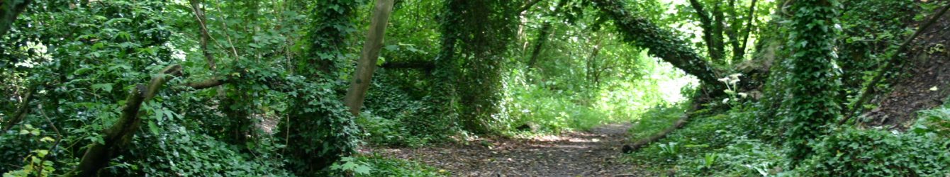
Let’s Get Creative

Local author, Cathy Farr is hosting another Creative Writing Day on 10th July in Dinas Powys.

Following the success of previous workshops over the last two years, Cathy will be welcoming budding writers to spend the day enjoying a host of practical writing activities that really will get those creative muscles going.

The sessions are inspired by the workshops and tutorials that Cathy attended when she was doing creative writing as part of her degree with the Open University. After achieving a 2.1 honours, Cathy has spent the past eight years developing her own teaching material as well as writing novels, and regularly hosts writing workshops in the Vale, as well as in schools.

‘The day is ideal for people who are interested in doing some creative writing but don’t really know where to start,’ says Cathy, author of six novels for children and adults. ‘You don’t have to be planning to write a novel; some people come simply to have a go at doing something a bit different.’

Cathy with her Irish
Wolfhound pups – the
breed that inspires her
writing.

Cathy’s main aim in these workshops is to give people the chance to let their own imagination do the work and to have some fun, too. Positive comments from people who have attended previous workshops include: ‘It was enjoyable, fun and really interesting. Your teaching methods enthused us all I think, they certainly did me, along with the wonderful character you brought to it, that is Cathy Farr!’

Cathy gives as much constructive feedback as possible during the day, which means that places are limited so early booking is advised. The workshop will be held on Wednesday, 10th July, 10.30a.m. to 3.30p.m. in the Lee Hall at the Parish Hall in the centre of Dinas Powys and the price is £45 including tea and coffee throughout the day. For more information and to book your place contact Cathy at cathy@bitebooks.co.uk or on 02920 511031.


Wenvoe’s Part In A Game Of Thrones

WENVOE’S PART IN A GAME OF THRONES

As Brexit heralds an uncertain future, it is worth a look back to what was going on in Wenvoe and other Vale villages during the turbulent summers of 1648 and 1649. Following a prolonged period of civil war between King and Parliament, our community was torn apart by the nearby Battle of St Fagans and in 1649 by the shocking trial and execution of King Charles I.


Civil wars are often the bitterest of conflicts dividing family members and friends alike. Ordinary people in Wenvoe however, probably did not understand what the war was about. For centuries they had been loyal to their King and Parliament. Farm labourers and their families in the local community suddenly found themselves on one side or the other. This decision was made for them by their social superiors and landlords, several of whom actually changed sides during the conflict.
The uncertainty and impact of these events must have been frightening. This cartoon from the time ‘The world turn’d upside down: or, A briefe description of the ridiculous fashions of these distracted times’ summed up how people would have felt about the perilous times in which they lived. It was a clever image summing up how ordinary life was undergoing strange and unpredictable change.
Local people had already suffered greatly in the years of conflict before 1648. Officials warned villagers if they didn’t pay wartime taxes they would be subject ‘at your peril of pillaging and plundering, and your houses fired and your persons imprisoned.’ Apart from those conscripted to fight, skilled craftsmen were forced to leave their homes to work for the armies.
The battle itself, in May 1648, involved around 11,000 men. It ended in victory for the well paid, trained and equipped Parliamentarian
forces. The Royalist army, who had hoped to restore Charles I to the throne, was routed. Many men from surrounding villages were ‘volunteered’ to join the Royalist army and bring their homemade weapons such as Welsh bills (a farming implement similar to a scythe) and clubs to the fight in the face of the cavalry, pikes, muskets and canon of the professional armies. The brutal fighting, much of which was close at hand, was reminiscent of what we saw in TV’s recent Game of Thrones. The exit wound of a musket shot was the size of a dinner plate and it was no surprise therefore that the River Ely was said to have flowed red with blood.
In the days following the battle, locals who had already witnessed horrific scenes and injuries were forced to help with mass burials of several hundred dead. One burial mound, which can still be found at Duffryn, is said to be the resting place of Royalists caught and killed when fleeing after the battle. Soldiers did not wear dog tags so once inevitably stripped of all possessions, bodies could not be identified. In local villages, the bereaved families never knew what happened to their loved ones. Survivors faced plundering at the hands of victorious soldiers. Diseases like bubonic plague and dysentery were spread by both armies. Farms were ruined. With food stores and farm animals seized for army use, starvation was inevitable. Vengeance was rife. Miles Button of Duffryn was captured and fined £5000 for his part on the Royalist side in the battle. His annual income was £400. His brother wasn’t so lucky. He was tried and executed for treason.
And what of the loyalty shown by our farm labourers to the King? Already by June 14th a poster appeared in Cowbridge calling all able bodied men between 16 and 60 to rendezvous with weapons and horse ready to fight for Parliament.


The Valeothon Event

Following on from last month’s article, we thought a little bit more information about the Valeothon event on Sunday 30 June wouldn’t go amiss.
The event will bring up to 200 riders to the village which is where the start and finish is located. We have the use of the Community Centre for our registration area and the Village Hall for a short time for extra toilet facilities. After 9 am the Vale Village Church will be using the Village Hall as usual.
The event will start from Station Road West and the riders will turn right and head out of the village along Old Port Road and up the hill towards Dyffryn.
There is a choice of 2 routes, a 40 mile route which sticks to the Vale of Glamorgan and an 80 mile route which goes through the valleys and up over the Bwlch mountain. The 80 mile route has a refreshment stop just after the descent from the Bwlch and both routes meet in Cowbridge for more cake and sweets before heading home to Wenvoe.
The event is supported by a number of local sponsors and is a non-profit making event. However, we
think we will have some surplus money after totting up the overheads, so we have decided to make a do-nation to Wenvoe School who would like some sports kit and we intend to make further charitable donations too.
However, we are well aware that this event will bring a lot of people to the village early on Sunday morning and we want to ensure that no one is inconvenienced as a result. No roads will be closed. The start/finish area will be marshalled to ensure there are no problems with access to drives and houses. This will mostly affect Station Road West, as this is where the riders will line up before setting off. Riders will start to arrive from about 7.00am and all riders will have left by 9.00am.
We will do our best to keep any disruption to a mini-mum and we will be advising all the riders to be respectful of the residents. We will definitely be picking up any litter.
We hope you will support us and perhaps get involved and cheer our riders on at the start and finish. Of course, we will encourage anyone who fancies a pint afterwards to call in at the Wenvoe Arms.
If you have any questions or concerns, please email us at: wenvoewheelers@gmail.com


Inaugural Carers Walk


The inaugural Carers walk took place at Barry Island on the last Thursday of April. The walkers experienced all 4 seasons in one hour as they strolled along the coastline: Winter rain on Nell’s Point, Summer sunshine on the promenade, Autumn wind in the gardens and Spring showers on exiting the cafe!

New research by Carers UK claim 6.5 million people are carers, or 1 in 8 adults and it’s anticipated that by 2037, the number of carers will increase to 9 million. Caring can be a lonely job and the walk for carers is offered to carers and their families to give some gentle exercise in a lovely seaside environment with good company!

Alan, a carer came along to the first walk and thoroughly enjoyed the walk, chat and tea!

If you would like to join us, we meet at the Barry Island train station on the last Thursday of every month at 10.30am.


Brecon Nature Reserve and Hidden Valley

Brecon Nature Reserve and Hidden Valley

We parked in the lay-by, on A470, at Brecon Nature reserve about a mile north of Storey Arms. A notice stated ‘In just a few hundred metres you will find yourself enclosed within a shady, atmospheric amphitheatre created by the soaring craggy cliffs of Craig Cerrig Gleisiad. The lofty exposed moorland of Fan Frynach separates this area from a second, equally spectacular curtain of cliffs at Craig Cwm Du. The steep rocky slopes, sharp escarpments and crags are home to rare arctic-alpine plants at their southernmost location in the UK and not found again until the Alps. A history of lower levels of grazing has resulted in a richer variety of wildflowers in the reserve compared with surrounding areas of the National Park.’

‘A glacier carved out this valley during the last ice age. As it melted about 18,000 years ago it exposed the steep rock walls of Craig Cerrig Gleisiad. Sometime later a catastrophic landslide cascaded millions of tonnes of rock from these crags down the slopes. You can still see the tension cracks in the bedrock. The extent of this landslide is visible as the steep bank you can see from the A470. Up until 11,500 years ago a smaller glacier occupied the back of the hollow, leaving a series of ridges of small rocks and debris called moraines.’

We took the right hand path, climbing immediately and were soon in the ‘amphitheatre’. We were wrapped in a silence broken only by birdsong. The place felt so peaceful and the whole area was covered in swathes of bluebells. Larks soared as we passed and the harsh call of members of the crow family echoed from the heights.

Gazing at the awesome hills around us their height seemed daunting but we gradually moved through the Nature reserve and found ourselves at Carnedd Cairn, 1 mile into the walk with a climb of 1,000ft under our belts – the hardest climb of the walk.

It was a fairly flat walk to the trig point at Fan Frynach(629m), where we took in the spectacular views: to the east Pen y Fan and to the west, in the distance, Carmarthen Fan with rolling farmland to the north and below us in the next valley.

We started to descend and after about 200 metres picked up a good path heading north to connect with Sarn Helen (a Roman metalled road which continues to Ystradfellte and its waterfalls). The path was well defined with a ditch at the side, a farm track perhaps or an old drover’s road? But looking at the land rising away from us we could see paths across it at regular intervals – so most probably old forestry commission land which has been returned to its

‘original’ state. We watched a pair of red kites soaring above us until they were driven away by crows.

On Sarn Helen we met a farmer sitting side-saddle on an off-roader with her 2 dogs. Soon a motor cyclist kicking up loads of dust approached us, closely followed by 4 more that slowed down and exchanged smiles.

Now we arrived at the Cwm Du valley, time for lunch; we walked a short way and sat beside the stream, Nant Cwm-du. The land was dotted with distinctive craggy trees sculpted by the harsh climate. We were enjoying the peaceful atmosphere, listening to the babble of the stream and watching a tiny caterpillar which wafted in front of us on an invisible thread. The silence was destroyed by the sound of a car engine, as a number of 4x4s drove along Sarn Helen. They were soon gone and peace reigned.

Walking up the valley, beside the stream, was easy to start, then and as we climbed became more difficult, making us crisscross the stream, until eventually we came to a waterfall, a vertical edge with excellent footholds enabling a climb out of the valley. We rested near the top on a large flat rock to admire the valley and absorb the atmosphere of the place. Then up to the Beacons Way – so nice to be on a footpath again and Pen y Fan came back into view.

Soon we were facing a steep descent back to the A470, taking a zigzag path on the steepest sections we eventually got to the bottom. Looking back at it was scary!

Throughout the walk we had heard the call of the cuckoo, we had seen lots of wildflowers, including tormentil, welsh poppies (not in flower), violets, speedwell and saxifrage. There were very few sheep and quite a few horses grazing the area. The weather was perfect, hardly any wind, cloudy with occasional weak sunshine, excellent visibility, cool temperature and most importantly – no rain. We had seen only 6 other walkers all day – a brilliant day. Walk 6½ miles, ascent 2000ft. MapOL12.


May Walk Report


Why does a walking report have a picture of smiling people sitting in a cafe, sipping coffee and eating cake, to accompany it?

The answer is straightforward: the chat and the coffee (other beverages are available!), are an important and integral part of any Cosmeston stroll. On this spring walk, Betty and Helen found themselves leading the walk. When Lynne caught them up and asked them to guide the group back to the cafe, they replied that they were too busy talking to know how to get back!

The good news is that we did get back. Two Canadian visitors joined the walk and thought Cosmeston Lake was as impressive as any lakes they have seen in Canada. I think they were being generous in their praise, but Cosmeston certainly is an attractive place at this time of the year.

If you would like to share in the beauty of a short stroll around Cosmeston and enjoy a chat during the walk and afterwards in the cafe, then we will meet you at 10:30 on the first Thursday of every month outside the information centre


Coed Morgannwg Way Above Hirwaun

Coed Morgannwg Way above Hirwaun

It was a lovely morning but as we got out of the cars, at the Mynydd Beili-glas viewpoint, we did a group shiver – the wind chill factor really hit us and we quickly set out so that we could warm up.

It had been a week of wintry showers and the ground around us still had snow lying in patches. We were close to Graig a Llyn, the highest point in Glamorgan at 1969ft and below us we could see the road snaking up the hill, with a white car roaring up round the bends, as if it was in a Grand Prix.

We could also see Llyn Fawr, a lake which was made into a reservoir in 1911. When this was done a number of ancient objects were found in the peat at the water’s edge. These became known as the Llyn Fawr hoard and include 2 large bronze cauldrons, bronze axes, sickles and a sword. Probably dating from around 600BC they are among the most important Iron Age objects found in Wales; they are now in the National Museum, Cardiff.

Initially we walked on natural footpaths which soon became roadways for the vehicles which installed the Pen Y Cymoedd wind farm. One advantage of the wider tracks was that we had good views all day.


We decided to take a slight detour from our route to visit a memorial stone at the spot where the body of Willy Llewellyn, aged 5 years, was found. He was lost in Aberaman on 11th April 1902 and his remains found on 26th April, after a search by the whole community. Offerings of coins and small toys were on the stone.

We passed through areas where the trees had been decimated by fire and maybe the road building but new saplings were springing up. For lunch we found a protected area, sitting on tree stumps and fallen trunks, enjoying the sunshine. Tiny red flowers of moss covered one of the stumps. Bright yellow flowers of coltsfoot decorated the ground as we continued.

Now the 500ft wind turbines were towering around us. A series of notice boards provided information on the wind farm – 76 wind turbines produce an estimated output of 256MW. Natural Resources Wales state that there are 211 wind turbines planned for the Welsh woodland estate. The estimated output is 663MW (enough to power over 416,000 homes). The turbine footprint will be 450 hectares of land not replanted (20% of the estate). [Aberthaw Power Station generating capacity 1,560MW]

We met no walkers all day but a few cyclists, one of whom stopped us and asked for directions – he’d bought a map online and it was ‘being delivered tomorrow’.

Soon we arrived at the wind farm electricity sub-station where a large electrical installation loomed over us like a huge robot. From here we walked along a road through a forest of wind turbines and returned to the cars via our original footpath. The peaks of Pen y Fan and Corn Ddu in the distance were both covered in snow.

Hirwaun (long meadow) Common below us was gifted to the people for free grazing of their animals. Also in sight was the Tower colliery, closed as uneconomic in 1994 but run as a co-operative by the miners for a further 13 years until the coal finally ran out in 2008. Walk 8miles ascent 800ft. Map 166.


Dyffryn


Dyffryn

The midweek walkers parked near the quarry man’s tribute and kept south of the St Lythan Road. Walking past one of the Wenvoe Wildlife Group orchards, people commented on the progress that had been made here and then walked north and west towards Dyffryn.

The sky which had been getting darker by the minute opened up and a deluge of hail descended on our heads. A few had umbrellas which were soon covered in ice with slush dripping off their edges. After cooling us down the shower passed on and the sky brightened a little only to be followed by another shower. Passing through a wood a flash of lightning was discounted momentarily but a rumble of thunder followed – at least the storm wasn’t near us.

At Dyffryn the warmth and hot drinks available were very welcome and we stayed quite a while. Then we walked up to the A48 and through The Downs, across open land and back to the cars. A lovely walk enlivened by the weather. Distance about 5.5mile


1 55 56 57 58 59 88